Route to the «Algayat»
Route to the «Algayat»
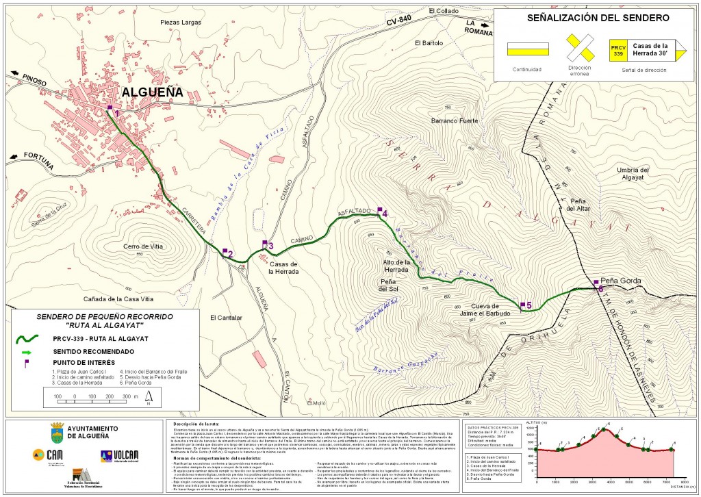
Starting Point: Juan Carlos I Square. Arrival Point: Plaza de Juan Carlos I. Approximate Elevation: From 520 m. At 1085 m. Estimated Time: 4 h. 20 min. Length: 5,524 m. Estimated Average Speed: 3 km / h. Approx. Difficulty: Medium / high. Terrain: Roads and trails.
Map of the route
Itinerary
The route goes by the mountain called «Peña Gorda», better known by the native population as Sierra de Algayat, site about a thousand five hundred meters east of the municipality of Algueña. The route is reached by the road that connects us with «El Cantón de Abanilla» (Murcia), turning left, by the first asphalted road that we find once left the town, where is located the «Village of the Herrada «(farm houses), and where we will see the first signs of orientation (kilometer 1), following which we will reach the ravine, through which we will reach the summit. The ascent is 2415 m. Approx. With an estimated duration of 2 h. 40 min. Approx. (Recommended for a stop of 30 min.) The length of the descent is 3115 m. Approx. And we will mount it through, with a duration of 1 h. And 50 min. Approx. During the course we can observe the abundant and varied flora and fauna of the place, as well as very steep walls that invite the practice of climbing, rappel, etc. During the trip we will pass through the interior of a ravine, with very thick vegetation, enjoying the landscape and the environmental wonders of the area. In addition, once at the top we will have an inimitable panoramic view, as we can observe: the town of Algueña, the Sierra de la Cruz, the Hill of Vitia, Mount Coto, El Cerro de la Sal, the hamlet of La Solana , The Sierra de la Espada, the Carche, Marachuelas, the Canton of Abanilla, etc.
